LE PLAN DE LA VILLE


VUE PAR SATELLITE DE LA VILLE DE BÔNE


carte michelin

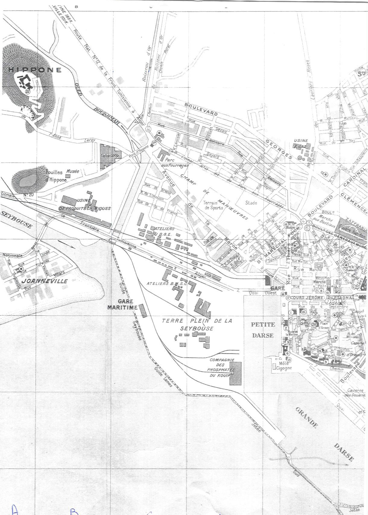
plan de Bône de Monsieur SEBASTIANI

http://www.profburp.com/plan/image3.htm

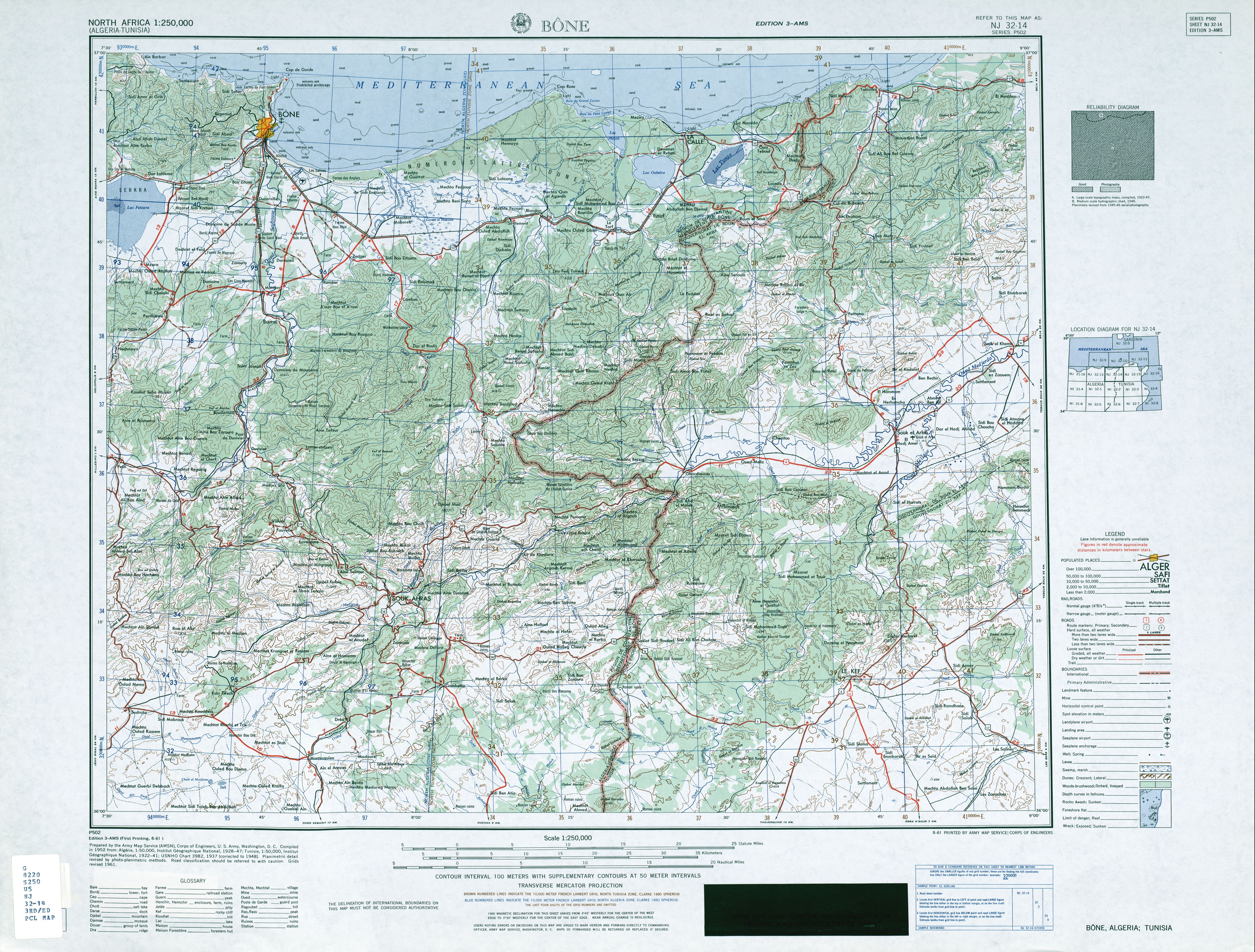
http://www.lib.utexas.edu/maps/ams/north_africa/txu-oclc-6949452-nj32-14-3rd-ed.jpg

Pour
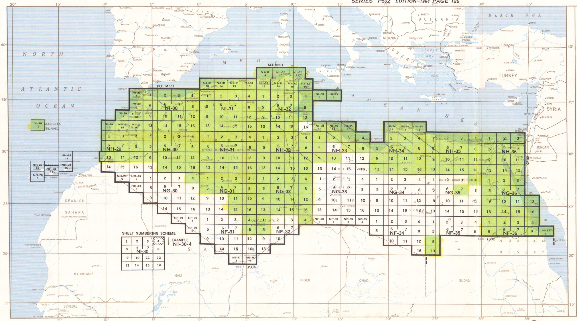
ceux qui ont des problèmes pour localiser la carte qui les intéresse:
La table d'assemblage est sur cette page:
http://www.lib.
Les cartes sont regroupées par carrés de 16.
Oran, par exemple, c'est la carte 4 du carré NI 30 et on la retrouve par
ordre alpha sous le nom de NI 30-4 sur la page
http://www.lib.
Pour ceux qui ont été sages, d'autres liens envoyés par Peter et Kathy Clark
avec des plans de villes dressés par l'US Army en 1942-1943 pour faciliter
les débarquements et les bombardements en AFN.
Algérie: http://www.lib.
Maroc: http://www.lib.
Tunisie: http://www.lib.
Ces plans pèsent parfois très lourd, plusieurs mégas, mais ils en feront
rêver plus d'un. Ceux qui ont connu ces villes à cette époque et ceux qui
aujourd'hui y vivent ou les découvrent.
Je vous souhaite à tous autant de plaisir que j'en ai pris à me promener
dans les rues de villes que j'ai connues plus tard ou dont j'ai toujours
entendu parler sans jamais y avoir mis les Pieds, quelle que soit leur
couleur.
Bertrand
Carthage http://www.profburp
Boufarik http://www.boufarik
Les entrepots http://profburp.
http://ouedmerda.
|
LE PLAN DE LA VILLE
VUE PAR SATELLITE DE LA VILLE DE BÔNE
Il y a une magnifique photo satellite du golfe de Bône sur
Bertrand
Carthage http://www.profburp.com
Boufarik http://www.boufarik.org L'entrepot http://profburp.free.fr
carte michelin
plan de Bône de Monsieur SEBASTIANI
http://www.profburp.com/plan/image3.htm
PAGE ACCUEIL ST AUGUSTIN PHOTOS DE CLASSES HIPPONE REVUE ENSEMBLE PHOTOS LES SITES ANNABA LES LIVRES ET VIDÉO LE PLAN COLONIE DE VACANCES LE MARÉCHAL JUIN LES AFRICAINS NOTRE-DAME D'AFRIQUE DOCUMENTS LE TOIT COLLECTIF BÔNOIS-RETROUVAILLES HISTOIRE LA MARINE EN ALGÉRIE MA FAMILLE PLAN DE LA COLONNE AVIS DE RECHERCHE PAGE HISTORIQUE CHRISTIAN AGIUS PAGE DE MONSIEUR ALBIN SEBASTIANI PHOTO DE MONSIEUR DAUBEZE/GUATTERI DAUBEZE 1 cartes Le Rowing club LIVRE D'OR ENVOI DE E-CARD PHOTO PANORAMIQUE HISTOIRE BÔNOISE PHOTOS Marcel TREELS PHOTOS FRANCINE NE(E) à Bône
|

